Site Topographical Mapping:- We conduct detailed surveys to capture existing ground conditions, contours, and physical features. Our mapping includes natural and man-made elements such as roads, trees, drains, and utilities. This forms the base for accurate planning and design.
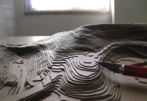
Contour Survey & Leveling:- We generate contour maps indicating elevation differences across the site. Our surveys help in understanding terrain profiles and slope conditions. This is essential for grading, drainage, and foundation planning.
Total Station & DGPS Survey:- We use advanced instruments like Total Station and DGPS for high-precision data collection. Our methodology ensures accuracy and efficiency in large and complex sites. Boundary & Demarcation Survey:- We identify and mark site boundaries as per legal records and coordinates. This helps avoid disputes and ensures correct land utilization. Accurate demarcation is critical for project execution.
As-Built Survey:- We prepare as-built drawings reflecting actual site conditions after construction. This ensures that executed work matches design specifications.
Road & Infrastructure Survey:- We conduct surveys for roads, drainage systems, and utility corridors. Our data supports alignment design and infrastructure planning. This ensures smooth and efficient project development.
Earthwork Calculation & Volume Analysis:- We calculate cut and fill quantities based on survey data. This helps in cost estimation and project planning. Accurate volume analysis reduces wastage and optimizes resources.
GIS Mapping & Data Processing:- We process survey data into digital formats using GIS and CAD tools. This allows better visualization and integration with design software. It enhances project planning and coordination.
Layout Setting & Marking:- We provide on-site layout marking as per approved drawings. Our team ensures correct positioning of structures and infrastructure. This improves execution accuracy and reduces rework.
Survey Reports & Documentation:- We deliver detailed survey reports, drawings, and digital data. Our documentation ensures clarity, accuracy, and easy usability. This supports smooth coordination among all project stakeholders.